
Surties Metro covers both Phase 1 lines: Corridor 1 (Sarthana to Dream City, 21.61 km with 20 stations) and Corridor 2 (Bhesan to Saroli, 18.74 km with 18 stations), including the key Majura Gate interchange station.

IPHONE • IPAD • SURAT METRO TRANSIT & NAVIGATION
Surties Metro: Station Route
Interactive Transit Map • Route Planner & Interchanges • Fare & Token Calculator • Train TimingsNavigate Surat's metro rail network with speed and confidence. Find the fastest routes between stations, calculate token fares, check train schedules, and locate nearest metro gates completely offline on iPhone and iPad.

Complete Surat Metro MapFastest Route & InterchangesAccurate Fare Calculator100% Offline Transit Navigation
Surties Metro: Station Route
Official Apple App Store Release • Developed by Softnoesis
Version
1.2.0
Stable Production iOS Release
App Rating
5.0 • Top Rated
Verified Commuter Reviews
EXPERIENCE SURTIES METRO ON IPHONE & IPAD
Explore the Signature iOS Feature Suite
Click through the tabs below to preview the mobile interface and see how Surties Metro makes daily city transit in Surat effortless.
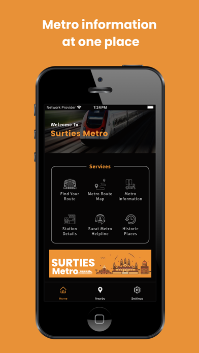
iOS Feature Spotlight
Comprehensive Vector Map of All Surat Metro Lines
Explore Surat's complete metro rail network with dynamic vector pinch-to-zoom clarity. Review both Corridor 1 (Sarthana to Dream City) and Corridor 2 (Bhesan to Saroli), check interchange junctions, underground tunnels, and elevated station terminals effortlessly.
- Corridor 1 & 2 Coverage: Clear color-coded transit routes for Sarthana-Dream City & Bhesan-Saroli.
- High-Res Vector Zoom: Smooth pinch-to-zoom map navigation without pixelation or lag.
- Key Transit Hubs: Highlights major connections to Surat Railway Station, Textile Market & Airport.
- 100% Offline Access: Browse the full subway map anywhere, even underground without signal.
COMPREHENSIVE TRANSIT SUITE
Built Exclusively for Surat's Daily Commuters & Visitors
Surties Metro combines precise station geographic data with offline route calculations for stress-free urban travel.
HD Interactive Network Map
High-definition vector route map of both Corridor 1 & Corridor 2 with smooth pinch-to-zoom navigation.
- Clear Red & Green line visual codes
- Highlights interchange junctions
- Identifies railway & airport link gates
- Smooth 60fps pan and pinch zooming
Smart Shortest Route Finder
Calculates the fastest route between any two metro stations with exact interchange platform directions.
- Instant travel time estimates
- Number of intermediate stops
- Step-by-step transfer instructions
- 1-tap reverse return journey trip
Exact Fare & Token Calculator
Know your travel costs in advance. Computes standard token rates and smart card concession discounts.
- Official GMRC tariff calculation
- Smart card discounted fares
- Round-trip ticket pricing preview
- Avoid counter queue surprises
First & Last Train Timings
Never miss your ride. Complete departure schedule tables from terminal and intermediate stations.
- First train morning start hours
- Last train night departure times
- Peak vs non-peak frequency tables
- Weekend holiday schedule variations
GPS Nearby Station Locator
Detects your live position in Surat and guides you to the nearest operational metro entry gate.
- Real-time GPS proximity distance
- Walking directions and time estimate
- Station gate exit numbers
- Nearby feeder bus connection info
100% Offline Transit Navigation
No network reception in underground tunnels? All maps, routes, and schedules are stored locally.
- Full functionality with zero mobile data
- Instant route computation speed
- Battery-conscious lightweight code
- Regular over-the-air line updates
Surties Metro Support
Questions or Feedback Regarding Surties Metro?
Our iOS development and urban transit engineering team at Softnoesis is here to assist you with metro route schedules, fare calculations, or station maps.
Clear Answers